Intelligent District Heating Network and Dispatcher Operation Dashboard – ConnectPoint project for Veolia Warszawa
The Intelligent District Heating Network is a project that aims to reduce CO2 emissions (by 14,500 tonnes per annum), network water losses and heat losses. It will be achieved through the modernisation of the infrastructure, the installation of metering equipment and remotely controlled equipment (3 remotely controlled pumping stations; 79 chambers and 2,500 substations), and state-of-the-art IT solutions.

The structure of the IT solution consists, in short, of:
- a layer of native systems responsible for communication with measurement and control devices,
- central data repository (CRD) consisting of the Asset Framework database (AF) responsible for data structure management and the PI database, which collects the measurement data stream,
- the ESB integration bus used to distribute data to relevant systems,
- analytical layer supporting dispatcher’s work,
- a presentation layer used to present all data in one place on a map.
DOD SYSTEM
DOD or Dispatcher Operation Dashboard is a module developed by ConnectPoint. The task set for the contractor was to collect and present all data necessary to manage the Warsaw District Heating System. The application works on the basis of ArcGIS for Server 10.4 map server and SQL database.
The set of collected data includes, among others, data on district heating infrastructure, which are downloaded from the GIS system currently operating at Veolia by issuing predefined database views. Pipeline sections, chambers, district heating substations, metering and shut-off devices are the layers forming one map service, which is the basis for each visualisation.
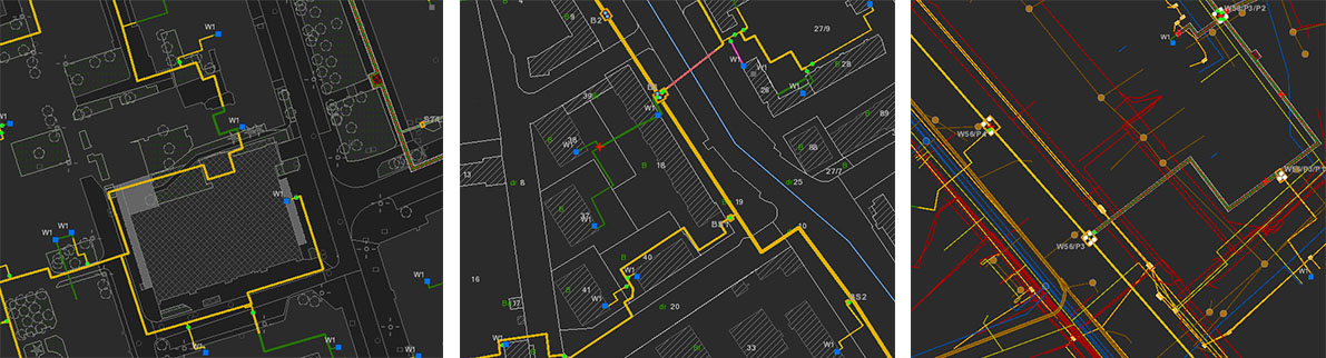
Figure 1.
In Figure 1, we can see the composition of the so-called exploitation layer with different elements of the core map: from the left the register of land and buildings (E overlay), then streets, pavements, lawns and ground infrastructure (S overlay) and underground infrastructure such as electrical cables, gas, waterworks, sewage systems, telephones (U overlay).
Aerial photographs are also the basis for many GIS-based analyses. Veolia provided a photo plan and thermal images in three colour profiles shown in Figure 2.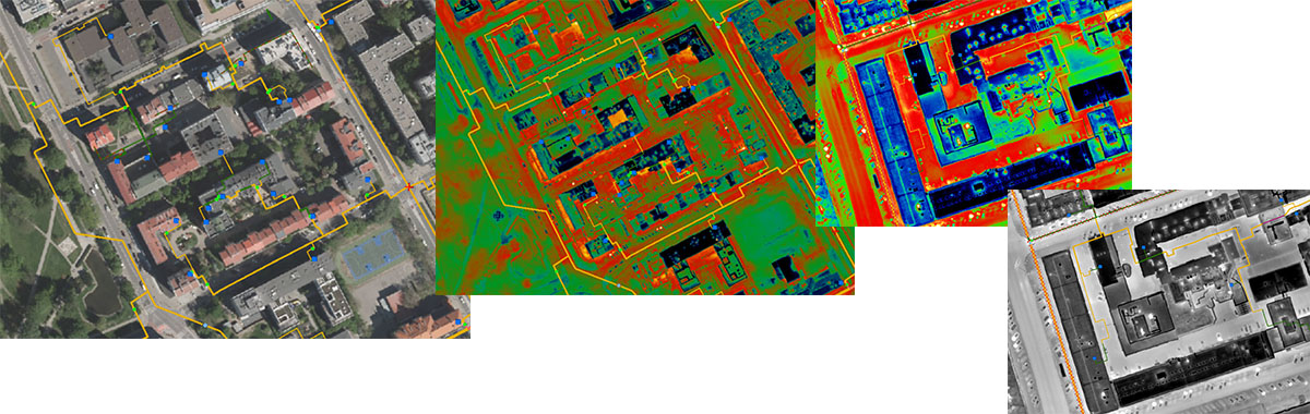
Figure 2.
Determining the distribution of pressure, temperature, heating medium transport time or power distribution between sources is a task for the hydraulic calculation simulator. It was integrated with the DOD through the ESB integration bus using the REST standard, making it possible to present all the information mentioned above on a map. These are shown in Figure 3.
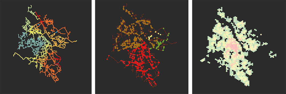
Figure 3.
Height maps, maps of groundwater level or simulation of a flooded area during the flood with the assumed specific water level in the Vistula River are the layers that support the dispatcher in assessing risks and threats related to the network operation. These issues are presented in Figure 4.
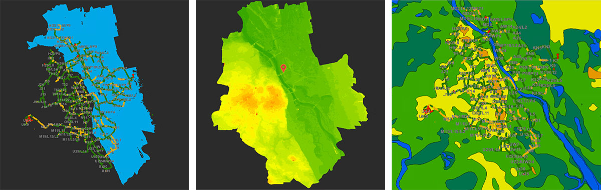
Figure 4.
Thanks to the integration with the billing system, assets management system, mobile application, GIS and field teams management application, the DOD application is at the centre of the emergency management process. The dispatcher can record all outages, including those related to network failures. After indicating the place of failure on the map, the dispatcher receives information about the nearest fittings enabling the separation of the area where the failure occurred. After closing the fittings, the dispatcher can see on the map the place of the failure, the closed fittings, disconnected sections and disconnected consumers and has access to the data related to the shutdown, such as the cost of shutdown or the amount of disconnected power.
OTHER BENEFITS
The DOD system is not only maps. It also includes many functions supporting the dispatcher in decision-making and many different types of registers.
A strategic district heating network diagram (basic diagram) is a diagram on which a dispatcher can see, among other things, the main chambers with fittings. The state of fittings presented in the scheme is registered in the central data repository. Through the integration with the PI system, we can read out the historical state of fittings on a particular day and at a specific time. From the basic diagram, it is possible to call up synoptic diagrams of individual chambers, which present real-time data such as pressure or temperature measurements (Figure 5).
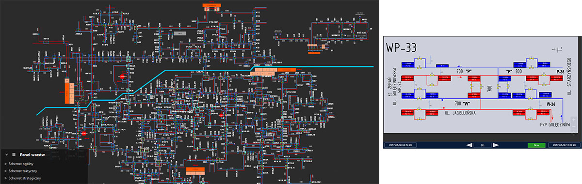
Figure 5.
The dispatcher’s work log is a registry that allows recording all events related to the dispatcher’s work. These are both reports received by the dispatcher and work orders given to the field teams or dispatchers managing heat sources. This register is integrated with the telephone exchange. On the dispatcher’s panel, you can see all incoming and outgoing calls, which are transformed into an entry in the log after selecting with the arrow. The dispatcher can go back and listen to any recorded call (Figure 6).
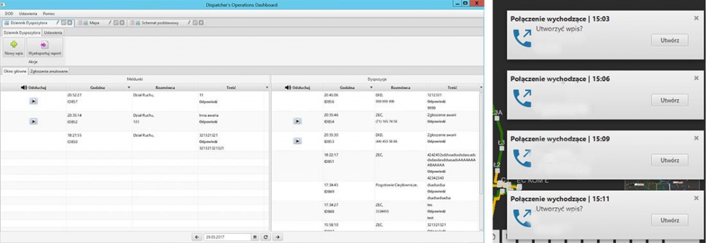
Figure 6.
Network operation scenarios developed by the Decision Support System as an element of the Intelligent Heat Distribution Network (ISC) are sent to the DOD and presented to the dispatcher in the form of table summaries. The dispatcher can compare many scenarios in terms of KPIs (cost, quality, quantity) and then accept one for implementation. DOD presents the individual steps of the scenario in charts (Figure 7) and on a map.
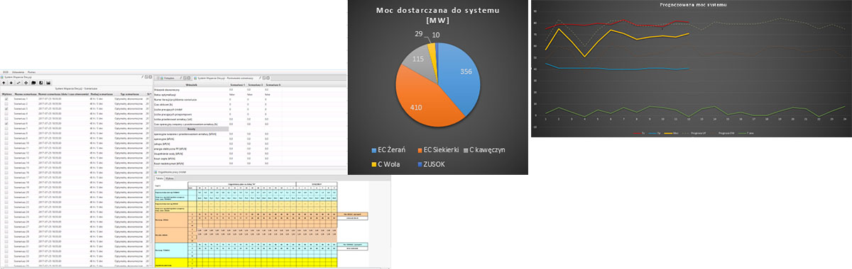
Figure 7.
Among other things, the solution enables the presentation of multiple maps, which can be linked to each other, registers, charts on the operator panel. The application fully complies with modern programming standards – (Java). An example DOD panel image is shown in Figure 8.
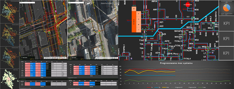
Figure 8.
To conclude, the development and implementation of the presented application is a considerable challenge for both the contractor and the customer. Integrating the results of multiple technically and business complex systems into a single efficient and user-friendly application will be a significant achievement. The implementation of this project will mean that Veolia will have a unique application, not only on a Polish but also on a global scale.
The article is also published in the ArcanGIS portal in Polish under this link: